Colorado wildfires: Crews bring largest fire under 34% containment as growth slows
Published in News & Features
DENVER — Fire crews working across western Colorado made more progress containing and slowing the growth of several wildfires Thursday.
The largest fire of the bunch — the Turner Gulch Fire near Gateway — is now 34% contained, a sharp improvement from 9% reported Thursday morning. The wildfire’s growth also slowed, increasing by 179 acres to 15,179 acres burned.
The South Rim fire, near Montrose, increased only slightly, though it remains at 0% containment. The Sowbelly fire near Delta remained at 2,274 acres burned as of Friday morning, though a fire map of the blaze hasn’t been updated since Thursday evening. Containment is also unchanged, at 16%. Crews also made progress containing the Utah side of the Deer Creek fire.
Collectively, the fires have burned more than 23,000 acres in Colorado since they ignited last week. Another brush fire — the Cottonwood Flat fire — was reported Thursday afternoon, prompting evacuation orders for residents with a mile of 1800 County Road 309. The fire was burning on that county road, south of I-70 between Rulison and Parachute. The nearby Highway 6 was reopened late Thursday night, the Garfield County Sheriff’s Office said.
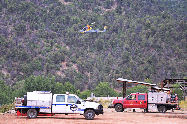
Turner Gulch fire and Wright Draw fire near Gateway
Firefighters have made more progress in containing the state’s largest wildfire, bringing the Turner Gulch blaze to 34% containment as of Friday morning, primarily on the fire’s western edge. That’s up from 9% Thursday morning. The fire has now burned 15,179 acres, a slower rate of growth than the 1,000 acres reported burned between Wednesday and Thursday.
“Today was a good day,” fire officials wrote on Facebook on Thursday night, adding that crews would spend the night “removing vegetation along the east side” of the fire.
Still, the Mesa County Sheriff’s Office on Thursday night issued a pre-evacuation notice for private land within the Uncompahgre National Forest from Forest Road 406 to 409. Officials have also launched an interactive evacuation map for the fires.
To the west, the nearby Wright Draw fire held steady at 448 acres for the third consecutive day, albeit with 0% contained.
The two fires are still burning around Highway 141, which is still closed between 7.40 Road and 16.10 Road at mile marker 124, according to the state Department of Transportation.
Deer Creek fire near Paradox
The wildfire burning near the Colorado-Utah border had burned 15,655 acres as of Friday morning, with 11% contained — up from 7% Thursday. The bulk of the blaze has burned in Utah, though more than 1,800 acres of Colorado land has been torched.
In a Thursday night update, fire officials said on Facebook that increased cloud cover and humidity, plus light winds, helped calm the fire’s behavior and contributed to additional containment on the fire’s western edge.
Friday’s forecast called for “a range of possibilities,” the officials wrote, with clouds and rain expected by mid-morning.
Fire maps showed Thursday that the Deer Creek fire was burning on a section of Colorado more than 2 miles long and wide.
South Rim fire near Montrose
The 4,227-acre South Rim fire grew 48 acres Thursday, another day of slow growth for a fire that ignited by lightning strike last weekend.
The fire, which is burning the Black Canyon of the Gunnison National Park, is still at 0% containment as of Friday morning, according to fire maps.
The national park remains closed to the public. None of the previously issued evacuation orders have been lifted, and several areas west, south and southeast of the fire — including the Bostwick Park area — remain under evacuation orders, according to the evacuation map.
--------------
©2025 MediaNews Group, Inc. Visit at denverpost.com. Distributed by Tribune Content Agency, LLC.


Comments